GeoSutra
Our Story
Services
Our Work
Observatory
Climate Analytics
Free Tools
Open Data
Information Hub
Research
Field Report
Careers
Contact
Our work
When places change, we go and look.
Manakamana
Nuwakot
Methodology
Orthomosaic · Kawasoti · 4.4 cm GSD
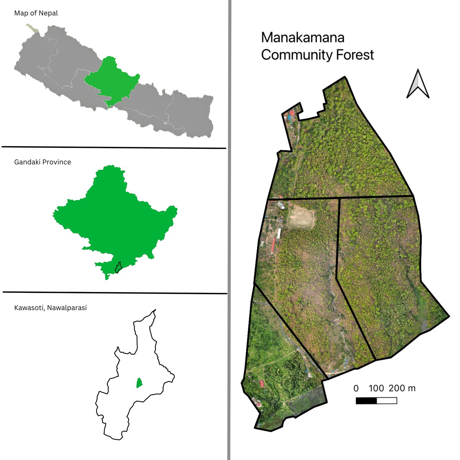
Shree Manakamana CF · Kawasoti
A forest, seen stem by stem.
People
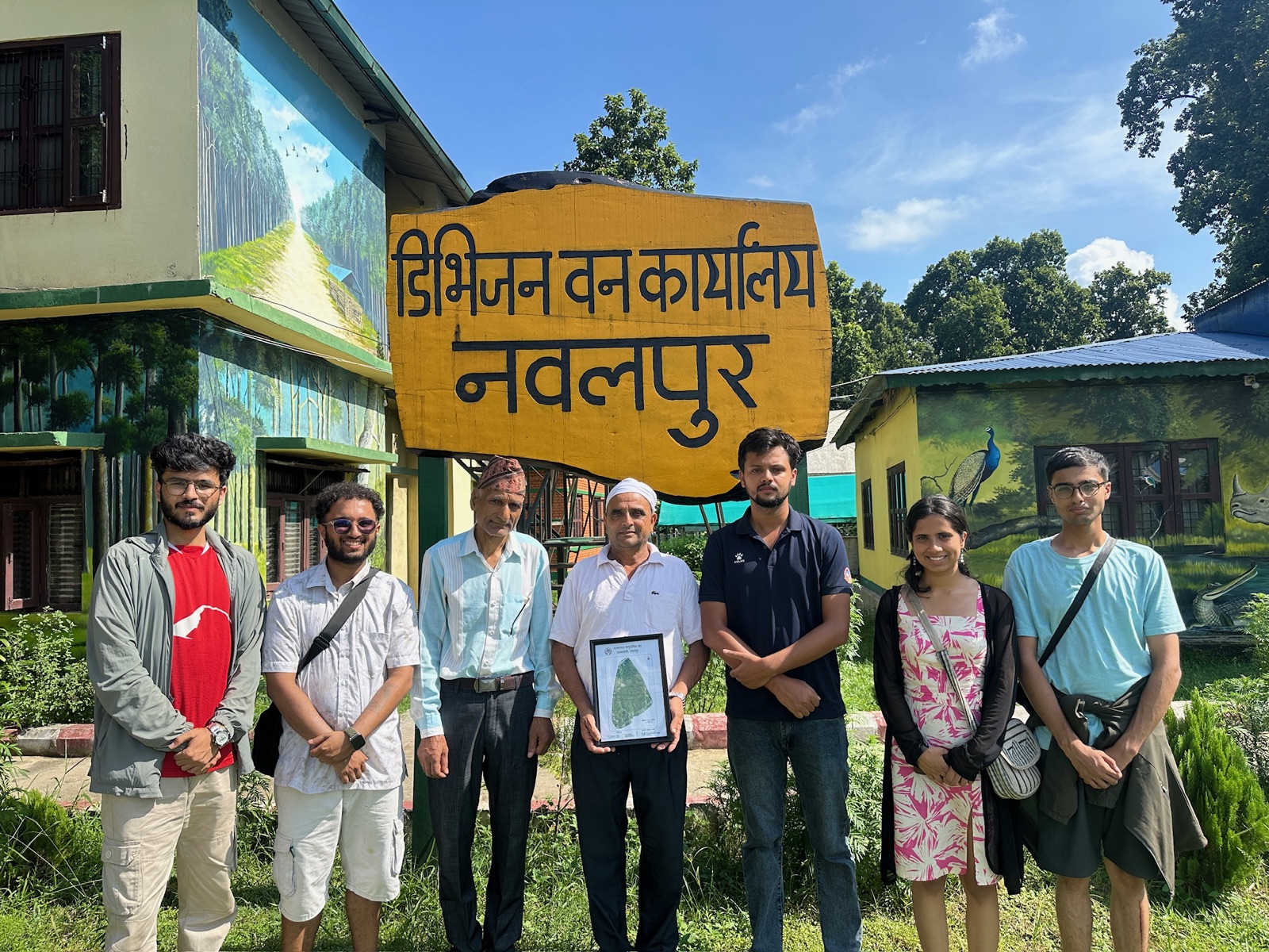
The user group and the Division Forest Office, Nawalpur.
Question
Can the forest be understood at individual-tree level to support its plan?
We added
Low-altitude UAV imagery, field plots, GIS and a locally retrained crown model.
Result
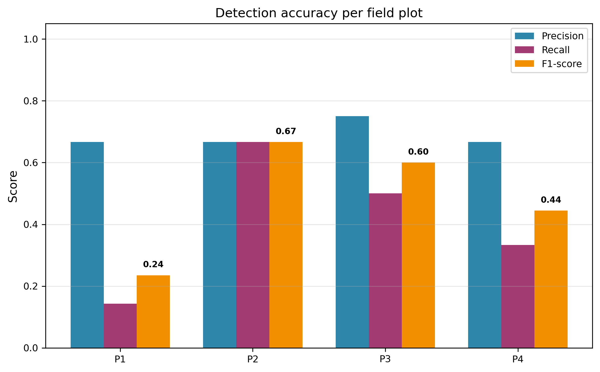
6,543 trees mapped at 4.4 cm, 0.73 mAP against field-checked crowns.
What changed
The stem map and stand statistics went to the user group and the DFO in a form the operational plan can use.
Uncertain
Detections are not a census; the 0.73 mAP applies to this site and season only.
Data
Crown polygons released openly
; orthomosaic held for the CFUG.
Open in the Observatory
Download the crowns
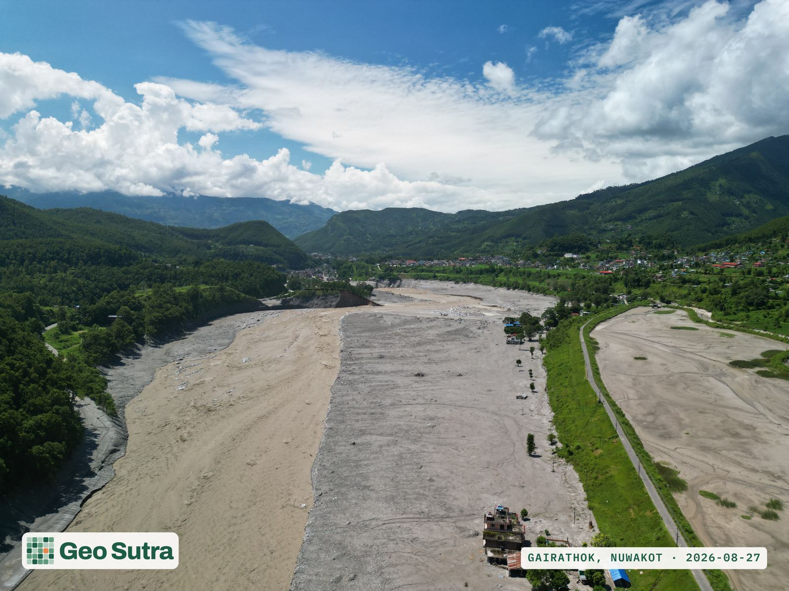
Trishuli corridor · Nuwakot · 27 Aug 2026
The morning after the flood.
Change
A glacier collapse sent a flash flood down the Trishuli; the channel through Nuwakot was rewritten overnight.
We did
Flew Gairathok, Bidur-10 and Tupche within 24 hours: 16 georeferenced frames, released openly.
What changed
The imagery reached responders while they were still deciding where to go, and stays open for recovery work.
Uncertain
Frames, not an orthomosaic; coverage is partial and damage counts come from NDRRMA and HOTOSM, not from us.
Read the field report
How we know
The method, shown.
4.4
cm
ground sample distance, UAV
0.73
mAP @ IoU 0.50, field-validated
DeepForest
retrained on Sal-dominated Nepali stands
Open formats
GeoTIFF · GeoJSON · CSV, with metadata
Individual-tree detections
Stems per hectare
Crown-area distribution
Model training curve
Accuracy vs field crowns
Study area · Nawalpur
Research & reports
Open data
 Orthomosaic · Kawasoti · 4.4 cm GSD
Orthomosaic · Kawasoti · 4.4 cm GSD
Orthomosaic · Kawasoti · 4.4 cm GSD
Orthomosaic · Kawasoti · 4.4 cm GSD
Orthomosaic · Kawasoti · 4.4 cm GSD