Field report · updated 11 September 2026 · NDRRMA

Nepal floods: the Trishuli corridor

On 26 August 2026, a glacier collapse above Rasuwagadhi on the Nepal–Tibet border sent a flash flood down the Trishuli corridor through Rasuwa, Nuwakot, Dhading, Tanahun, Gorkha, Chitwan and both Nawalparasi districts. Within 24 hours our drone crew was flying Nuwakot, capturing ground-truth imagery while responders were still working out where to go. The event is now widely referred to internationally as the 2026 Nepal–Tibet floods.

GeoSutra is a youth-led environmental data company based in Kathmandu. This page shows what our survey team documented on the ground and points to the official government channel for anyone who wants to help. See how to help below.

GeoSutra in action

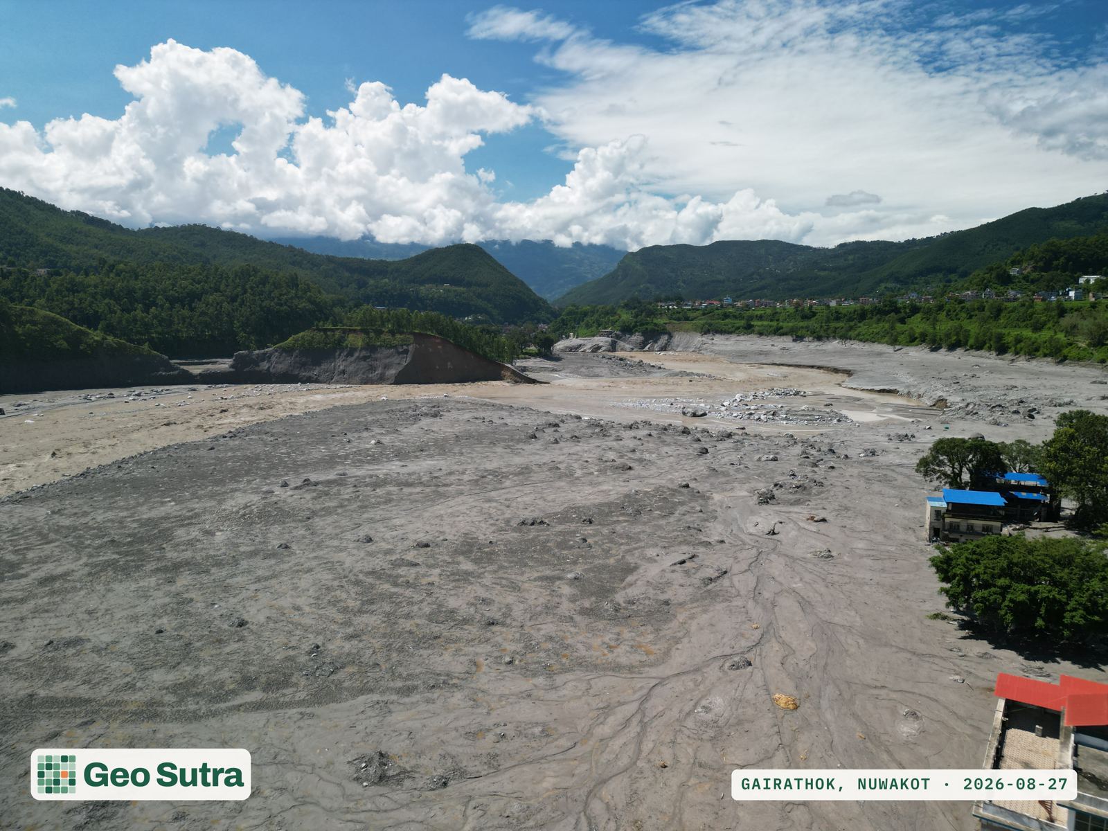
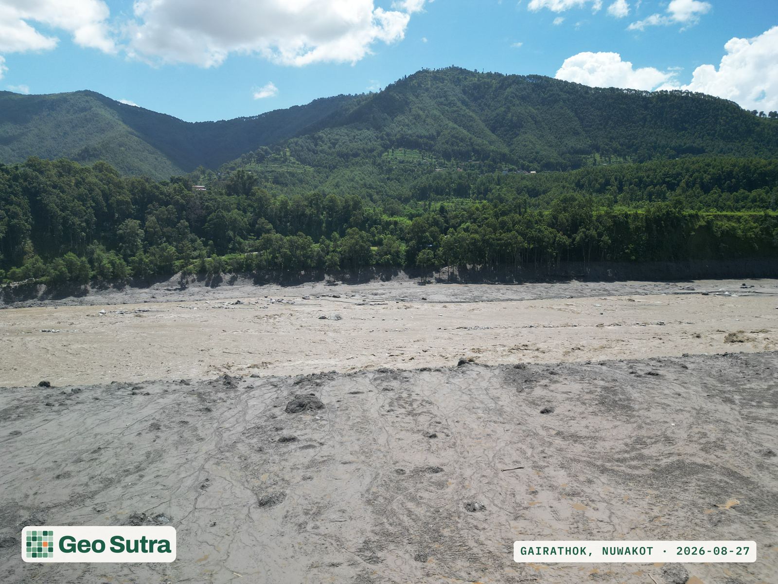
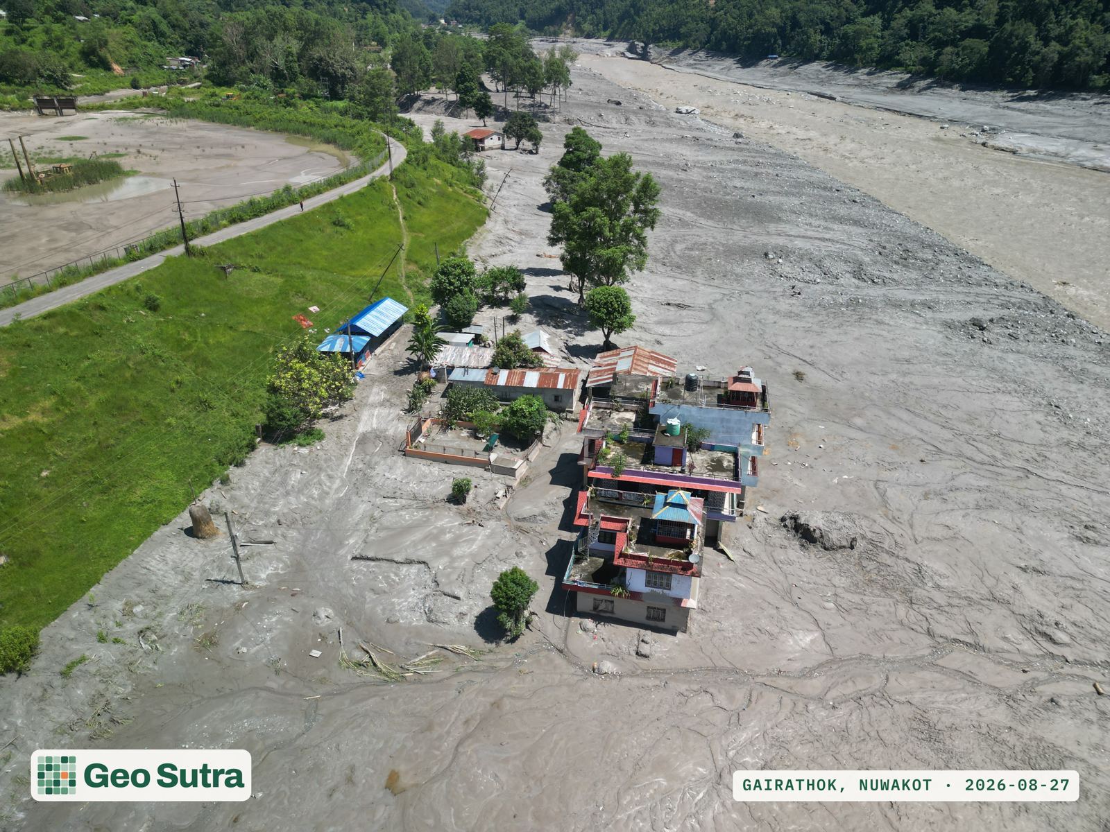
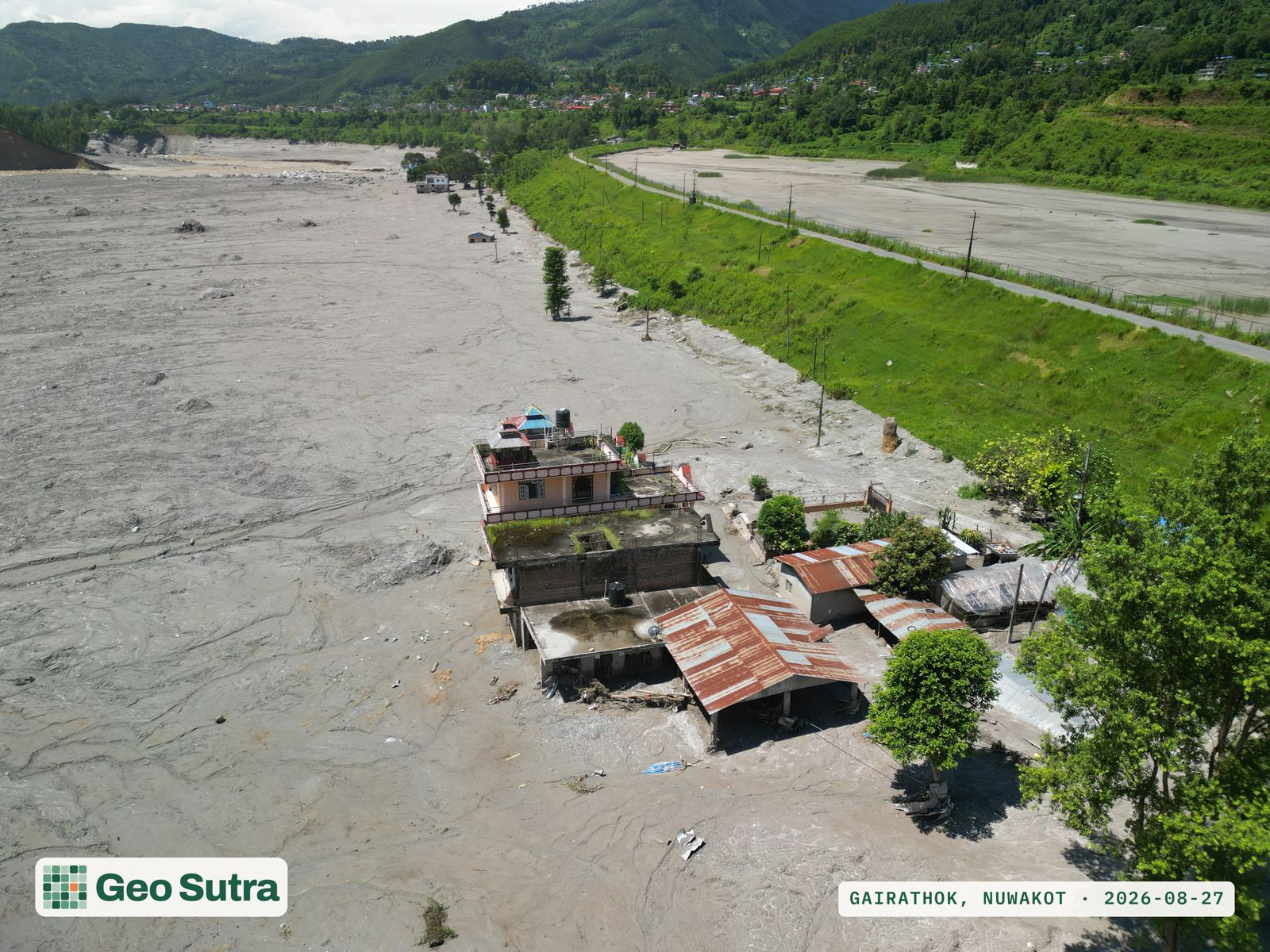
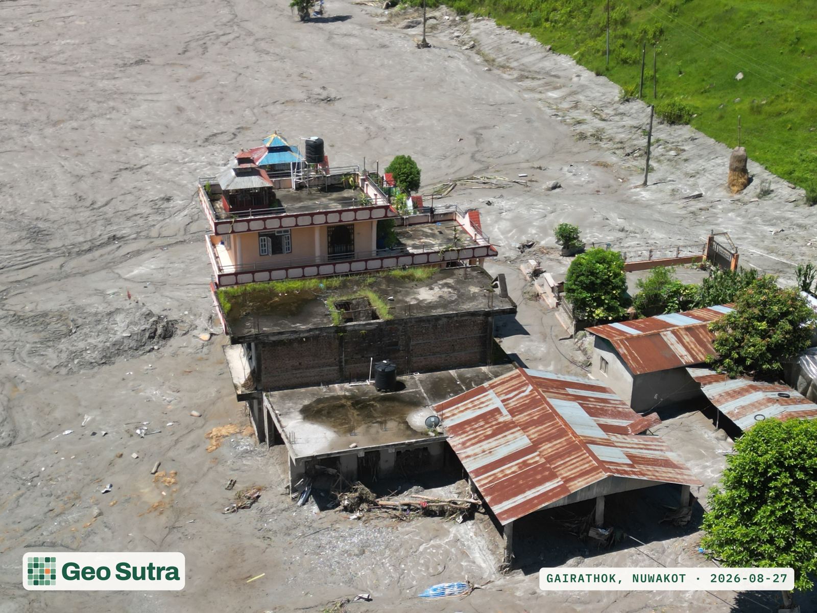
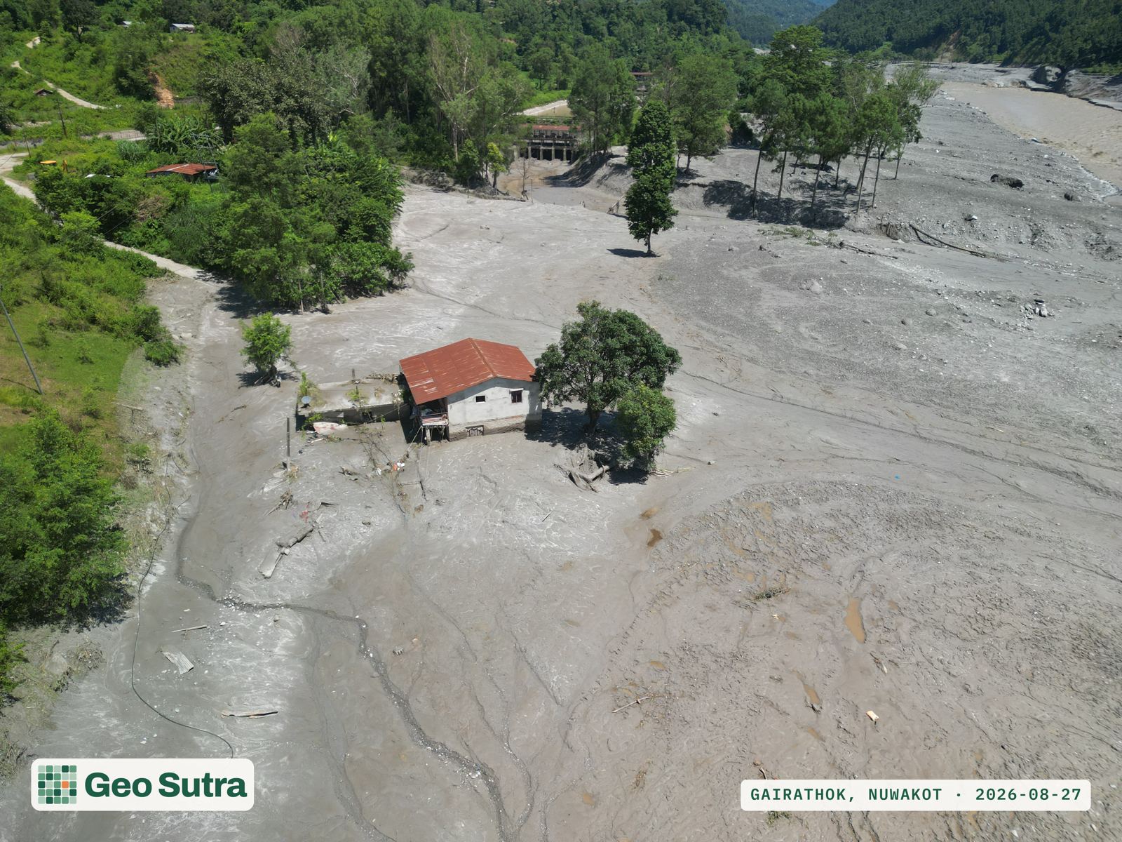
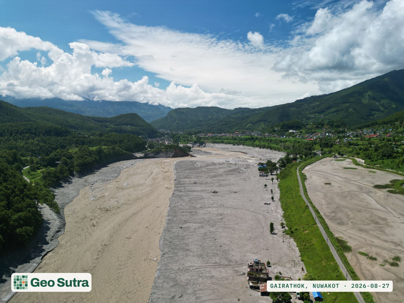
We were in the air within a day.

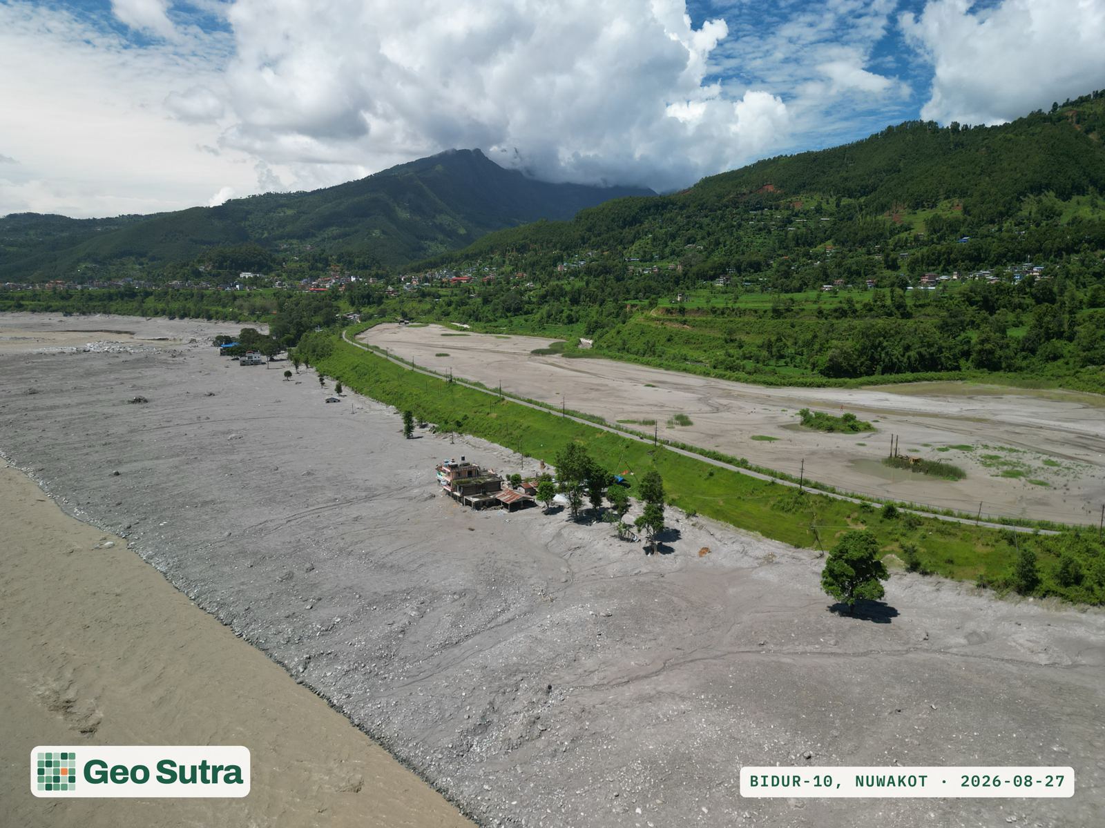
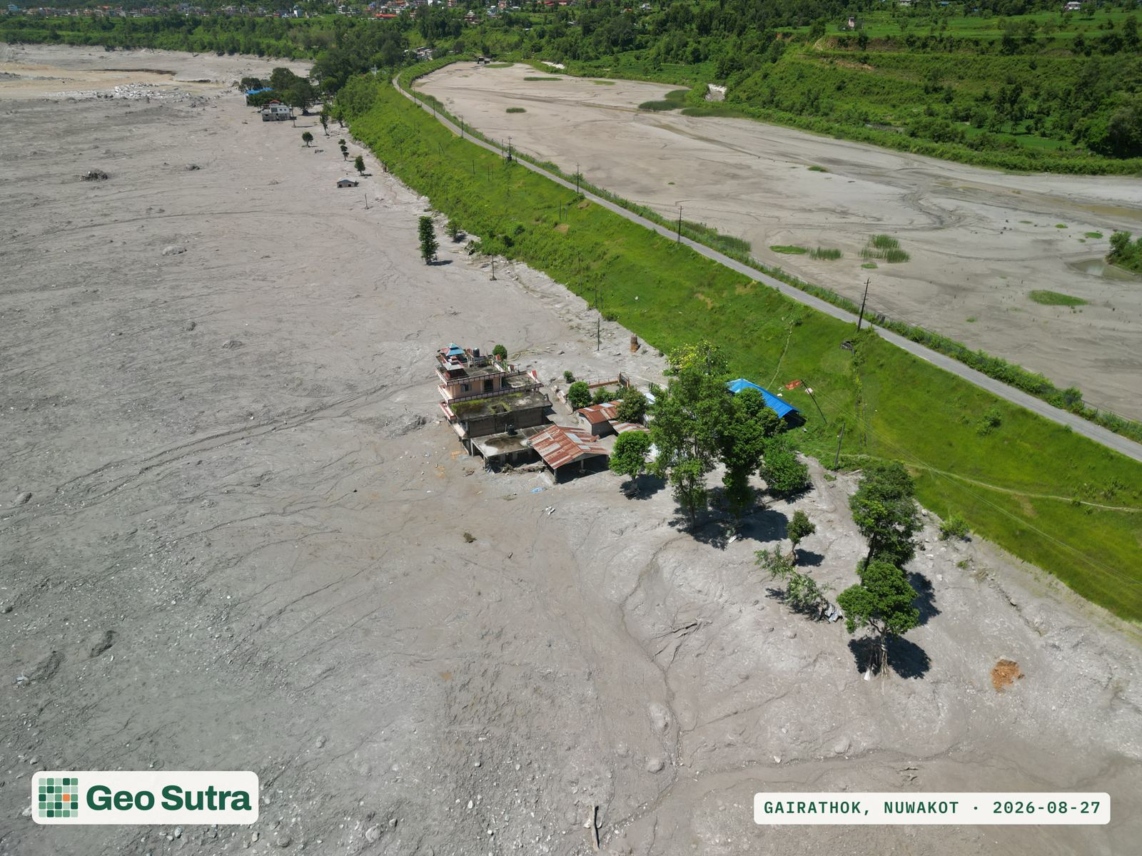
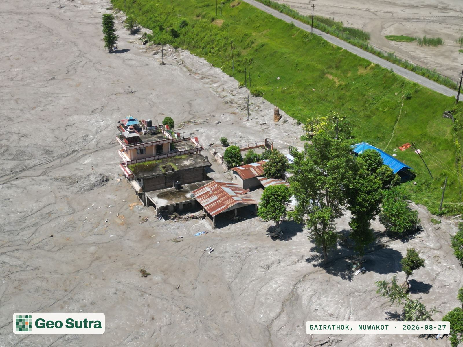
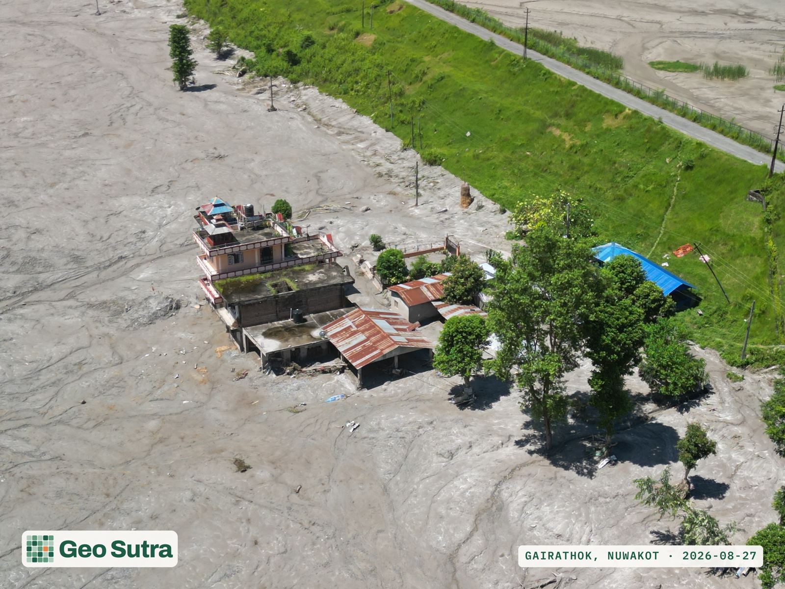
This is the same rapid-assessment capability we run for community forests and carbon projects, pointed at a disaster instead: fly, georeference, deliver. No report weeks out. Ground-truth reached responders' hands while it still mattered.

3
Settlements surveyed
16
Aerial frames captured
<24h
Flood to first flight
27 Aug
Survey date

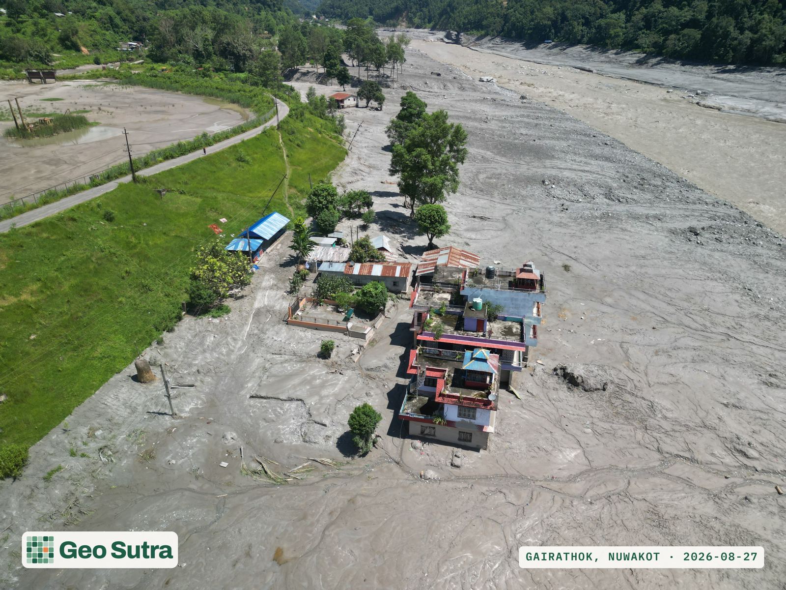
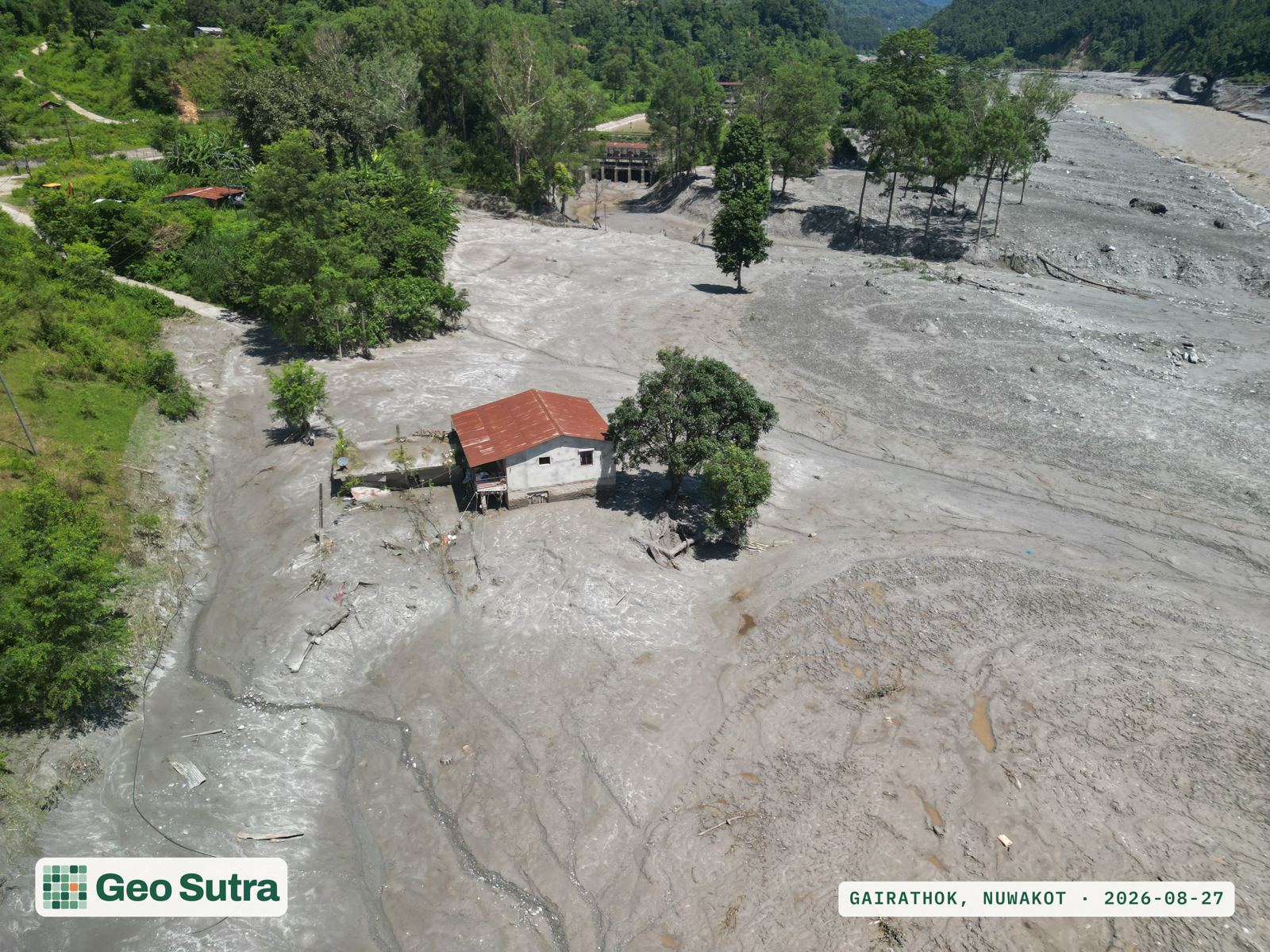
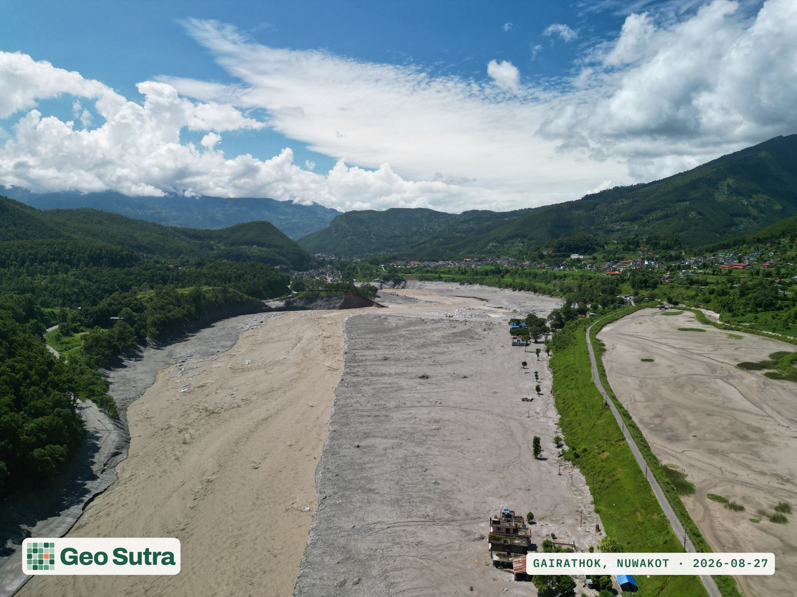
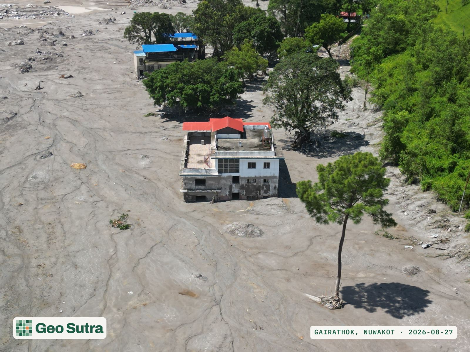
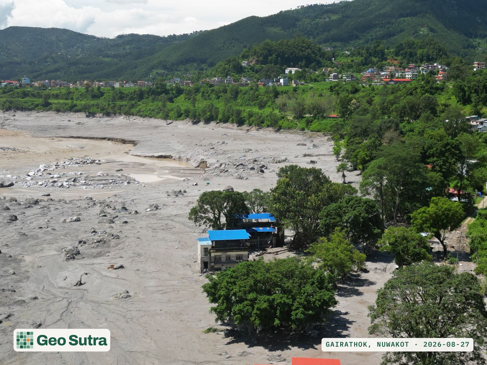
Gairathok, Bidur-10 and Tupche, Nuwakot: flown the morning after. Click any frame for the full-resolution image. The Asian Disaster Preparedness Center's field team, visiting Devighat and Dhunge in the same Bidur Municipality corridor the same day, independently reported the same picture: bridges and roads gone, buildings buried in mud to roof height, and upstream communities still unreachable.

© GeoSutra. Aerial documentation, shared for situational awareness and open to reuse with credit to GeoSutra.

Where we flew

Survey coverage: Gairathok, Bidur-10 & Tupche

These three Nuwakot settlements are where our crew flew on 27 August, a day after the flood reached the Trishuli. The wider corridor and its other affected districts are shown for context, not as a survey record.

Surveyed by GeoSutra Other affected area (context)

Survey-site coordinates are our own. Corridor points from the source down to Galchhi follow the Center for Land Surface Hazards' field reporting; points further downstream (Tanahun, Chitwan, Nawalparasi) are approximate town/district-HQ positions for orientation, not surveyed boundaries.

What caused it

A glacier collapse, not an earthquake

The flood was triggered by an ice-rock avalanche near Langtang Lirung and Tsangbu Ri, where a section of glacier gave way into the Lhende Khola catchment above Rasuwagadhi. The collapse briefly dammed the river before releasing a fast-moving, sediment-laden flood downstream. The flood reportedly moved at up to 75 km/h, and reports describe the Trishuli rising roughly nine metres in thirty minutes at Galchhi, about 50 km from the source. It is the same failure-then-release pattern recorded in a smaller flood on this same river in July 2025.

A satellite-based rapid hazard assessment (HiRisk/AMAA/Stimson, RHA NP3) identifies the source more precisely: part of glacier RGI2000-v7.0-G-15-05732, together with an unknown depth of underlying bedrock, detached across roughly 1 to 1.3 km of width at about 5,200 m elevation, mobilising material down to around 3,000 m. The debris met deposits left by a smaller 2025 glacial-lake outburst flood in the Lhende Khola and dammed the river there, apparently for only a few minutes, before that dam failed and released the flood, with flow speeds above 30 m/s (over 100 km/h) estimated in the upper reach.

The collapse registered as a magnitude 5.2 seismic signal. USGS first treated it as a possible tectonic earthquake, then reclassified it as a landslide-generated signal: large mass movements can shake the ground as hard as a moderate fault rupture. A Taiwan landslide read M4.9 in 2025, and an Alaska landslide that triggered a local tsunami read M5.4 the same year. The exact failure sequence, and whether a pre-existing glacial lake played a role, remain under investigation; the International Charter Space and Major Disasters has been activated to support satellite-based impact mapping.

Downstream, the flood wave covered the roughly 168 km from the source to the Narayani at Devghat in about eight hours. A 9-metre rise in thirty minutes was recorded at Galchhi and a 7-metre rise at Malekhu; the flow peaked at Devghat around 16:00 at roughly 5,850 m³/s, some 20 million m³ above normal flow. Nepal's Department of Mines and Geology separately recorded a magnitude-4.4 tremor at 08:37, three minutes before the flood signal reached the Betrawati gauge; the Asian Disaster Preparedness Center's field assessment attributes the shaking to the avalanche's impact rather than a tectonic trigger, consistent with USGS's own reclassification. Source: DHM Flood Forecasting Division technical report; ADPC preliminary field assessment, 27 Aug 2026.

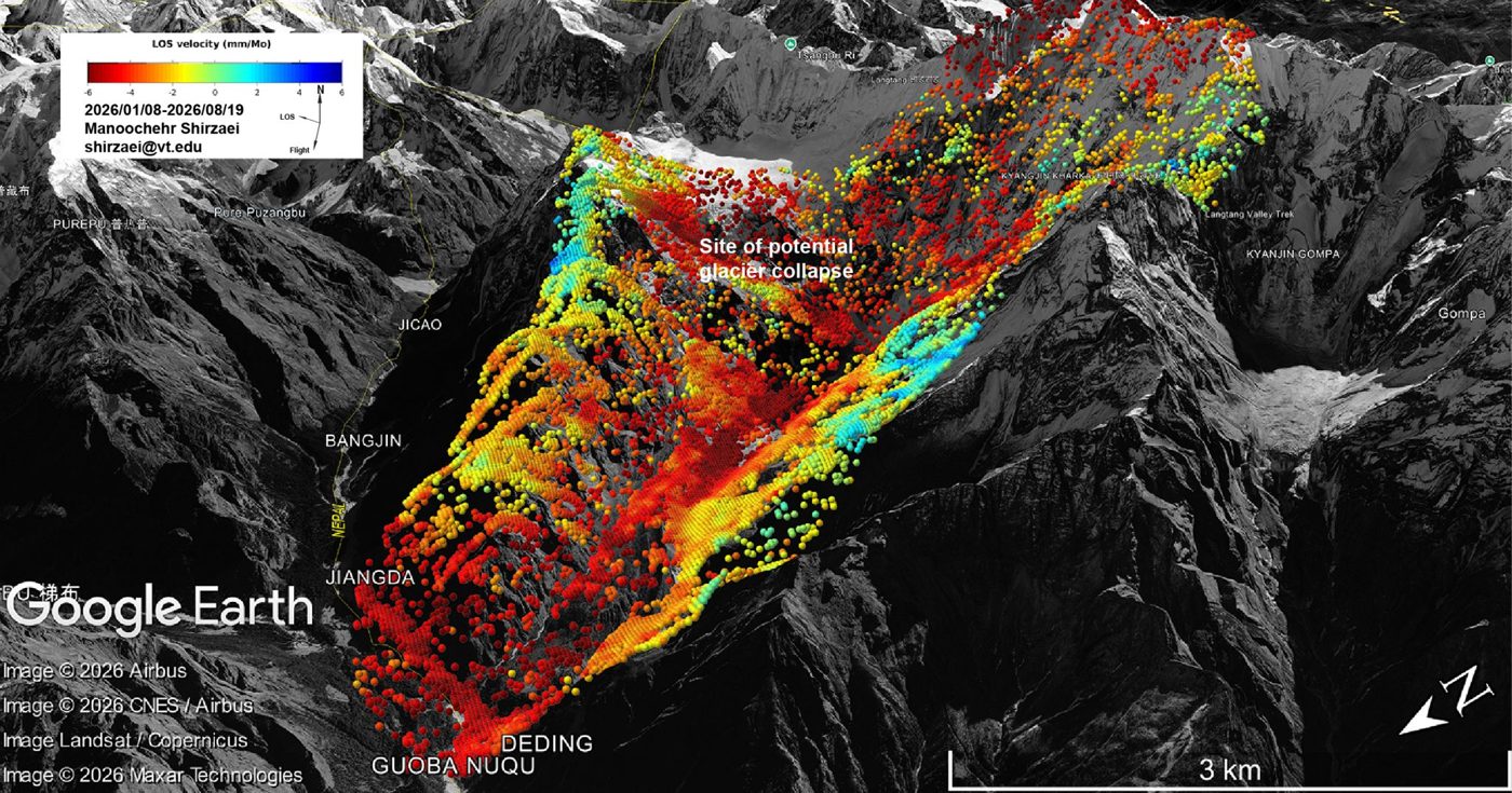
Satellite radar (InSAR) line-of-sight velocity map over the Langtang / Tsangbu Ri area, showing ground deformation and the site later flagged as a potential glacier collapse.

Independent satellite-radar monitoring had flagged this exact slope, near Tsangbu Ri above the Langtang valley, as a "site of potential glacier collapse" months before it failed. Line-of-sight ground-velocity measurements (mm/month) span 8 Jan–19 Aug 2026; red indicates motion away from the satellite. Data and analysis: Manoochehr Shirzaei, Virginia Tech. Basemap imagery: Google Earth / Airbus, CNES/Airbus, Landsat/Copernicus, Maxar Technologies.

Context

Not the first, and not the last

Rasuwa was hit by a destructive flood on this same river system in July 2025, a warning that went largely unheeded. Five years earlier, the 2021 Melamchi flood struck the neighbouring Indrawati basin, driven by a mix of monsoon rain, rain-on-snow and a lake breach, and moved an estimated 75 million cubic metres of sediment. That same year, the Chamoli disaster in the Indian Himalaya showed how a single rock-ice avalanche can trigger a flood that erases infrastructure tens of kilometres downstream.

Each of these events had a different trigger, but they share a setting: high-elevation slopes where glaciers are thinning, permafrost is thawing, and precipitation is shifting from snow to rain, destabilising terrain faster than the roads, hydropower stations and settlements built beneath it can adapt to. The Langtang Lirung massif itself has repeatedly produced large rock-ice avalanches, especially since the 2015 earthquake (Zhuang et al., 2024), including a separate rock-ice avalanche in July 2024 on the other side of Rasuwagadhi. Potentially unstable ice and rock remain on the glacier above the 26 August failure zone, so smaller follow-on events are considered possible (HiRisk/AMAA/Stimson, RHA NP3). Boulder deposits in the Trishuli valley studied by Huber et al. (2020) record floods of comparable scale roughly once every 5,000 years. By that record, this may be the largest flood through this valley in five millennia, and early field reports suggest it may have moved larger material than the last one did. The rebuild-or-relocate debate has already started: former finance minister Rameshwor Khanal and geologist Prof. Khumnarayan Paudyal have both urged moving some settlements to safer ground, noting that in several locations the flood destroyed the land itself and not just the structures on it, while the government's own risk studies are still pending.

The toll

The situation, briefly

1,377
Confirmed dead
5,130
Still missing
6,827
Injured
1.6M
People affected (NDRRMA)
8
Districts affected
68
Bridges destroyed (33 suspension + 35 motorable)
431
MW of power capacity shut down (~10% of Nepal's total)
$4.77B
Full reconstruction need (Govt. RDNA, NPR 723.32bn)

Figures are provisional and move quickly: the Government's own Rapid Damage and Needs Assessment (RDNA) recorded, as of 6:00pm on 10 September, 1,377 recovered bodies and records of human remains, 5,130 people still recorded as missing (revised down after 104 identified bodies were removed from the missing-person list) and 13,676 rescued — categories the RDNA itself cautions are not mutually exclusive counts of individuals. NDRRMA's operational bulletin the following day put the dead count slightly higher, at 1,385, with the same missing and rescued totals, and separately recorded 6,827 injured and 337 people hospitalised across 19 facilities (261 discharged), plus 3,559 treated by the Nepal Army and 3,759 by the Armed Police Force through separate medical channels. As of 10 September, 3,685 people were also recorded in 37 holding centres across Rasuwa, Nuwakot and Dhading (2,615 in Nuwakot, 775 in Rasuwa, 295 in Dhading). The rise in the missing count reflects search teams and telecoms reaching previously cut-off communities as roads and networks reopened. This is not a second disaster: the figures are expected to keep shifting as recovery continues. NDRRMA's own damage assessment, presented 4 September by executive director Dr. Dharmraj Upreti, put preliminary losses at $2.56 billion (NPR 387.5 billion), refining the Finance Ministry's rougher $4–5 billion estimate from a week earlier. The Government's Rapid Damage and Needs Assessment (RDNA) — led by NDRRMA with the National Planning Commission, information consolidated to 3 September and finalised 10 September — puts total disaster effects (damage plus economic losses) at USD 2,695.33 million (NPR 40,828.91 crore: USD 1,812.01 million in physical damage, USD 883.32 million in economic losses), equivalent to about 6.69% of Nepal's FY2024/25 nominal GDP. Total recovery and reconstruction needs come to USD 4,774.99 million (NPR 72,331.52 crore, about 11.84% of GDP): infrastructure NPR 473.57bn (energy and grid NPR 390.62bn; roads and bridges NPR 73.34bn; telecommunications, water supply, irrigation and household renewable energy the remaining NPR 9.61bn), the social sector NPR 103.54bn (private buildings and household assets NPR 95.83bn — across the 7,570 affected buildings, 8,317 households and 32,963 people the RDNA itself associates with them, a narrower, building-based estimate than NDRRMA's broader 1.6 million-person figure above and not directly comparable to it — plus 18 schools, 7 health facilities and 30 heritage sites), the productive sector NPR 50.77bn, disaster risk reduction NPR 94.75bn, debris management NPR 0.52bn and inclusive-recovery provisions NPR 0.15bn — split into an NPR 8.74 billion six-month emergency phase and an NPR 714.58 billion long-term phase. Energy, private buildings and disaster-risk-reduction works together account for over four-fifths of total recovery needs. Roughly $52.6 million (NPR 7.95 billion) is needed for the first four months of early recovery alone. At least 7,500 houses were destroyed and roughly 20,000 need full or partial rebuilding; officials estimate 2.2 million tonnes of debris require clearance. Separately, 84,270 people across 17 municipalities in six districts were directly affected, on top of NDRRMA's broader 1.6 million-person impact estimate above; UNICEF puts the number of children affected at 17,000. Bridge and power figures above are from a 28 August rapid hazard assessment (HiRisk/AMAA/Stimson, RHA NP3); an earlier NDRRMA-sourced count a day before (ADPC field assessment, 27 Aug) had put bridge damage at 80 (35 motorable + 45 suspension), about 40 km of paved road, and three hydropower plants (Rasuwagadhi, Chilime, Trishuli-3A) with a 220 kV substation disrupted. A further 470 MW of under-construction hydropower capacity was also damaged, and the Trishuli 220 kV 3B Hub Substation, this corridor's power hub, was completely destroyed. Confirmed damage separately includes severe destruction at the Rasuwagadhi customs point, Nepal's principal trade gateway with China, where over 500 vehicles were reportedly swept away and 15 customs staff remain missing; the Rs 3 billion Timure dry port was also destroyed. The barrier lake reported at the source on 27 August breached the following day; Nepal's Flood Forecasting Division reported on 5 September that this lower lake has since largely drained, while a second, higher lake near the collapse site (about 0.19 km², roughly 600,000 m³) has risen but remains below its danger threshold. China's Ministry of Water Resources, monitoring the site by drone, says the impact crater itself has largely drained with normal river flow resuming downstream, but that the surrounding glacier and ice mass still pose a potential avalanche hazard, so monitoring continues. Full bulletins: NDRRMA's Rasuwa-Bhotekoshi bulletins and live tracking (OnlineKhabar, 5 Sept 2026; the independent Rasuwa-Bhotekoshi flood bulletin, 6 Sept 2026) and the Nepal Flood Forecasting Division; damage assessment: NDRRMA via The Daily Star (4 Sept 2026) and Nagarik News (3 Sept 2026); affected-population detail: Business Standard (4 Sept 2026); children affected: UNICEF via Ekantipur (1 Sept 2026); barrier-lake status: Dharana News (5 Sept 2026) and Kathmandu Post (28 Aug 2026); infrastructure and hazard detail: Nepal's Ministry of Energy, China's Ministry of Water Resources, ADPC's preliminary field assessment, and HiRisk/AMAA/Stimson's RHA NP3 (27–28 Aug 2026). Updated toll and recovery needs, 10–11 September: Government of Nepal, NDRRMA/National Planning Commission, Rapid Damage and Needs Assessment (RDNA), Rasuwa-Bhotekoshi Flood 2026 (September 2026), Section 3.1 and Table 8; NDRRMA's operational bulletin the following day via the independent Rasuwa–Bhotekoshi flood bulletin and Himalpress.

Two weeks on, recovery is visible but partial. The Nepal Electricity Authority reports grid power restored to about 83% of Rasuwa and 95% of Nuwakot as of 9 September, with solar kits distributed to shelters and households still off-grid. The Nepali Army's 60-metre temporary Acrow bridge at Devighat in Bidur, built in five days, reopened to pedestrians on 10 September and to vehicles the next day, restoring the main link into Nuwakot; further downstream, only 18 of 63 bridges along the wider Rasuwa-to-Chitwan corridor remain usable, and China has delivered two 100-metre Bailey bridges toward the worst gaps. The Rasuwagadhi–Kerung border crossing with Tibet, by contrast, remains closed indefinitely: the flood destroyed the Timure customs yard, the Miteri bridge and the approach road, and no reopening date has been set. A comparable closure after 2025's smaller flood on this same river lasted about six months before a temporary Bailey bridge allowed cargo-only traffic. Sources: Kathmandu Post (8–9 Sept 2026); OnlineKhabar (Rasuwa customs point, Sept 2026); Travel Himalaya Nepal (border status, Sept 2026).
Crowdsourced verification

What the volunteer mapping shows

Beyond our own survey, the Humanitarian OpenStreetMap Team's open Tasking Manager campaign for this flood has volunteers checking the whole Bhote Koshi–Trishuli corridor against satellite imagery and ground reports, bridge by bridge and building by building.

51
Bridges ground-assessed
39
Reported washed out
4,431
Features flagged destroyed/damaged
20,366
Buildings mapped in the corridor

Of the 158 bridge crossings mapped along the corridor, 51 have been ground-assessed so far: 39 reported washed out, 2 damaged, 10 intact. Separately, mappers have flagged 2,033 features as destroyed or damaged across the wider area: 1,598 buildings, 225 roads and 42 further bridges among them, against a base map of 3,431 mapped road segments and 678 waterway features (rivers, streams and canals) across the corridor. By mid-September the base map itself had grown as more of the corridor was surveyed: roughly 20,366 buildings, 2,283 road segments, 400 waterway features and 162 bridges were mapped, with 4,431 features flagged destroyed or damaged in total, per HOT's own data-quality dashboard. A separate satellite-based exposure analysis (HiRisk/AMAA/Stimson, built on this same OSM building data) found 4,598 buildings intersecting the modelled 27 August flood extent (4,305 of them fully inside it), concentrated in Nuwakot (2,421), Dhading (891), Rasuwa (894), Gorkha (214) and Chitwan (78). This is open data (OpenStreetMap, ODbL licence), updated continuously as more of the corridor is checked. See the data quality report and interactive map, or join the mapping effort yourself.

Ground data

Bridges, clinics and shelter along the corridor

A closer look at the response layer: every named bridge crossing assessed so far between Rasuwagadhi and Chitwan, plus the health posts, security posts and lodging that responders and evacuees are working with. Toggle layers on or off, or tap a marker for detail.

Bridge washed out Bridge damaged Bridge intact Health facility Police / fire Lodging / shelter candidate

Bridge status is from the response team's own field and desk assessment ("2083/05/10 Trishuli Disaster – Bridge Inventory," updated 28 August 2026): of 39 named crossings recorded so far, 32 are washed out, 3 damaged and 4 intact. Health, security and lodging points are OpenStreetMap facility data (ODbL licence) for the corridor, shown here as possible staging points, not a verified operational-status list. Check directly before relying on any one site. The wider dataset behind this map also covers roughly 3,258 mapped buildings, 3,788 road segments, 155 schools, 385 settlement points and 69 administrative wards, available on request for anyone doing further GIS or logistics work on the response.

How to help

Donate through the official channel

The Government of Nepal's Prime Minister's Disaster Relief Fund (PMDRF) is the government's official mechanism for channelling relief and rehabilitation funds for this disaster. By law it is restricted to rescue, treatment, relief, rehabilitation and infrastructure (not administrative cost) and is subject to annual audit.

QR code linking to the official Prime Minister's Disaster Relief Fund donation portal, pmdrf.nchl.com.np

Scan to open the official portal

Donate at pmdrf.nchl.com.np →

Card, mobile banking, QR (NepalPay / Fonepay) and SWIFT transfers are all accepted directly on the official portal, in NPR or USD.

Bank account details, for direct transfer
BankBranchAccount no.SWIFT
Nepal Rastra Bank–cleared: Himalayan BankHiti Durbar (USD)HIMANPKA
Standard Chartered Bank NepalNaxal01013243801 / 02013243801SCBLNPKA
Rastriya Banijya BankPutalisadak1130100003762001RBBANPKA
Everest BankSinghadurbar00100105200270 / 00101102200012EVBLNPKA
Nepal BankKathmandu00211600510039000003 / 00200100510039000001NEBLNPKA
Global IME BankSanogaucharan00401010000057 / 00411010000005GLBBNPKA
Nabil BankTeendhara1710017505285NARBNPKA
Agricultural Development BankRamshahpath0100201002907014ADBLNPKA

Account name on all of the above: Prime Minister's Disaster Relief Fund. We've transcribed these from published sources. Cross-check the number against pmdrf.nchl.com.np or your embassy before a large transfer.

Also accepting direct donations: Nepal Red Cross Society, active in the affected districts.

Have GIS skills and a laptop? The Humanitarian OpenStreetMap Team is running an active crowdsourced mapping campaign for this flood. It's the same kind of volunteer geospatial work our own team does, open to anyone who wants to help remotely.

⚠ Fundraising scams are common in the first days after a disaster. Only use account details published directly by the Prime Minister's Office (pmdrf.nchl.com.np), your embassy, or the Nepal Red Cross, not screenshots or forwarded messages, however credible they look.
Beyond this event

More from GeoSutra

The drone survey above draws on the same platform we run day to day for forests, carbon projects and climate risk.

Sources: NDRRMA bulletins; Kathmandu Post, 27 Aug 2026; CNN, 28 Aug 2026; pmdrf.nchl.com.np; Nepal Flood Forecasting Division; the Center for Land Surface Hazards' live StoryMap on this event; USGS's landslide-event page; ICIMOD; the Asian Disaster Preparedness Center's Preliminary Field Assessment Report of the Bhote Koshi Flash Flood (27 Aug 2026); HiRisk/AMAA/Stimson's Rapid Hazard Assessment Report NP3 (28 Aug 2026); NDRRMA's Rasuwa-Bhotekoshi Flood Situation Report #1 (1 Sept 2026); the Finance Ministry's early estimate via Reuters, 29 Aug 2026; Kathmandu Post, 28 Aug 2026, on the barrier-lake breach; OnlineKhabar, 5 Sept 2026; the independent Rasuwa–Bhotekoshi flood bulletin (6 Sept 2026); The Daily Star, 4 Sept 2026, on NDRRMA's formal damage assessment; Nagarik News, 3 Sept 2026; Business Standard, 4 Sept 2026; Ekantipur, 1 Sept 2026, via UNICEF, on children affected; Dharana News, 5 Sept 2026, on barrier-lake status; Lokaantar, 3 Sept 2026, on resettlement planning; and the Humanitarian OpenStreetMap Team's open bridge and building damage mapping for this flood (data as of 30 Aug 2026, OpenStreetMap contributors, ODbL). This is a fast-moving event; please verify anything load-bearing against these primary sources.